
Firstly I have to say that I may have never blogged under more stunning circumstances. It is the 3rd of October 2019. I am alone (kids still asleep), enjoying the view of the sunrise as our cruise ship slowly makes its way into the French Riviera to the port of Cannes where we will be spending our day. I am reminiscing the recent Schynige Platte to First hike as I hear great music playing and as I sip my delicious black coffee… life cannot be kinder to me right now.
Now let’s talk about another stunning hike you can do in Switzerland which I would love to share with you.
The reason I decided to go on this hike was because I wanted to make the most of a full day out. I wanted a long, somewhat strenuous hike – it had to be at least 15km and take at least 5 hours. The fact that it offers the most gorgeous views at every turn is the reason I am so grateful to call this alpine country my home.
Hike Statistics:
Distance: 16 km
Duration: 6 hours (We completed it in under 4 hours with a short lunch break overlooking Lake Brienz in between)
Ascent: 825 m
Descent: 639 m
Turn by turn directions:
Schynige Platte – Oberberg – Loucherhorn – Egg – Faulhorn – Bachalpsee – First
How to Get There:
We took a train from Basel to Interlaken Ost, changed trains to get to Wilderswil.
We got off and bought the combo tickets to go up from Wilderswil to Schynige Platte and down from First to Grindelwald. This costs CHF 62 or CHF 31 if you have the GA or the Half-price card.
It took about 4 hours to get from Basel to the top of Schynige Platte.
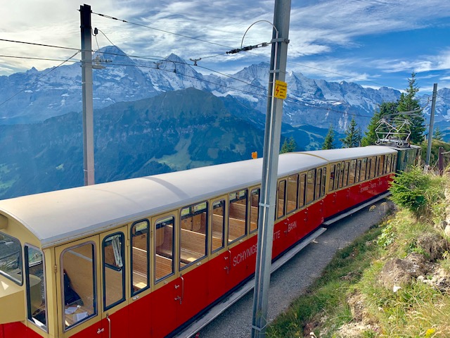
The scenic, almost one hour cogwheel train ride from Wilderswil to Schynige Platte covers a distance of 7.3 km as it climbs a height of 1,420 metres. Please note that this train only operates from the start of June to the end of October.
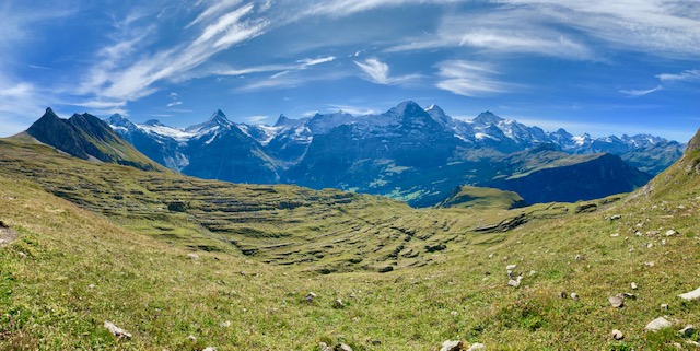
The views en route is worth the distance and time it takes to get there. We could see the trail of the previous hike we had done from Harder Kulm (above Interlaken) to Augsmatthorn (part of the Hardergrat trail) as we ascended the mountain. Apart from views of Lakes Thun and Brienz, you will be sure to marvel at the uninterrupted views of the famous 3 Bernese (the Eiger, Mönch and Jungfrau).
There is actually a lot you can do at Scyhnige Platte itself with photo points, an adventure playground and the new Swiss flower and panorama trail.
We did a quick climb from the train station to see the views and quickly left to start our hike to First.
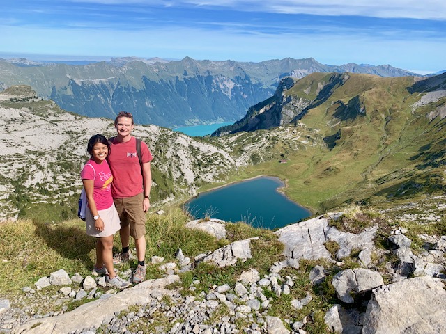
Schynige Platte to First Hike – My Impressions:
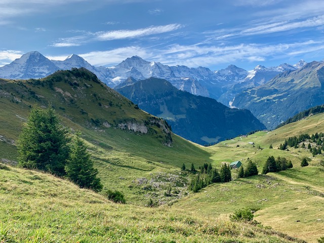
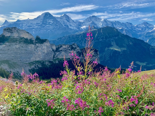
What made this hike incredibly special was the constant amazing views of the yet ever changing landscape, giving you different perspectives of the surrounding Bernese mountains, lakes and valleys.
I did not feel that there was ever a particularly sharp ascend at any time. The uphill bits were always gentle, rather than steep (unlike at the Pizol 5 Lakes Hike or getting up to Suggiture on the Hardergrat Trail).
You could easily see the views of the majestic 3 Bernese for a big part of the first portion of the hike.
Looking back you can still see Lake Brienz in the distance.
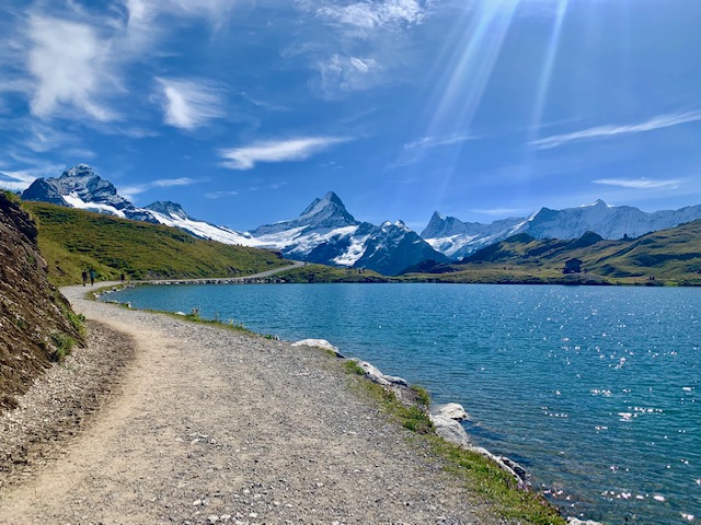
We then came across our first lake on the hike, Sägistalsee, from which you get a great view of the Hardergrat Trail and Lake Brienz.
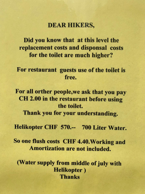
Continuing on, we reached Berghaus Männdlenen (2344m), a mountain hotel and restaurant which had the most interesting sign at its entrance, explaining to hikers why they must charge non-guests to use their toilets. I shall let you read in the picture below.
We had made up a lot of time by this point. We could still see Lake Brienz on our left as we made our way uphill with views of the mountains around Lake Luzern in the far distance on the left.
By then it was clear where we were headed towards – Faulhorn, once described as the ladies’ peak as no significant mountaineering skills are required to climb it.
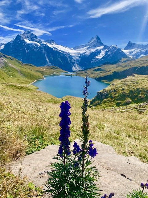
We didn’t make it up the peak of Faulhorn but chose to pass it instead, continuing downhill towards Bachalpsee.
We encountered more people as we were slowly approaching the end of the hike. Most were tourists doing the hike from First to Bachalpsee.
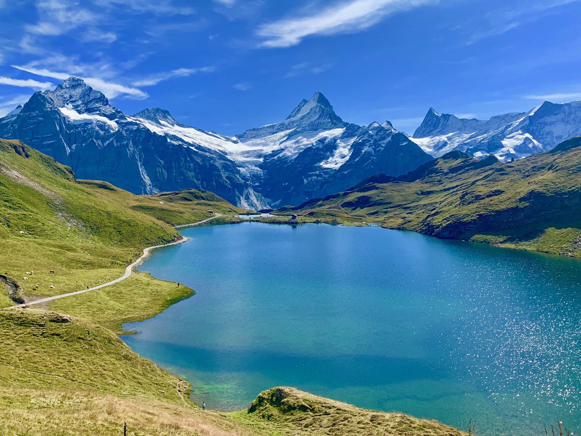
The cows lounging in the sun with views of Bachalpsee and the surrounding mountains were a sight to behold. Do these Swiss cows have any idea how lucky they are to live in such a beautiful place?
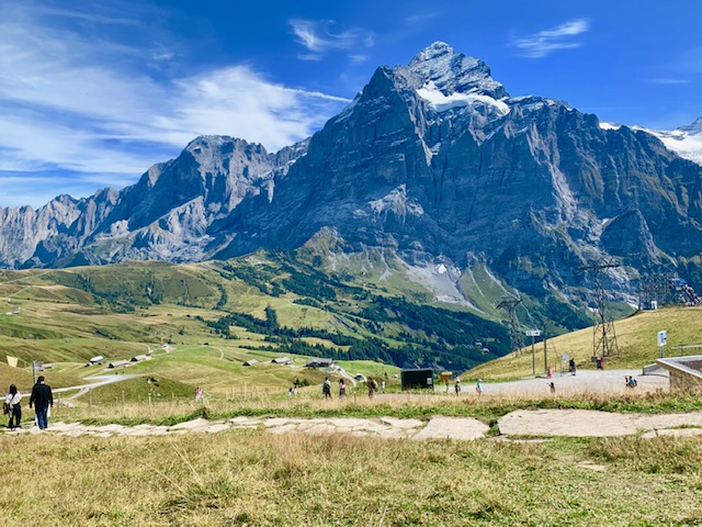
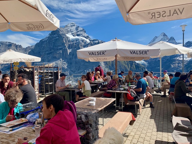
Finally we reached the First aerial cableway summit station, home to the adventure capital of the Grindelwald area. The first thing we did was to have our proper lunch break with views of Wetterhorn.
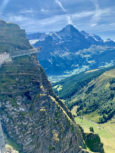
We then made the walk on the First Cliff Walk.
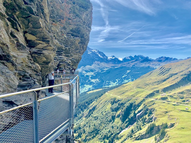
With views of the alpine pastures, the surrounding mountains, waterfalls and more, this was a great way to end our hike. This may be slightly challenging for those afraid of heights.
Before descending down with the cable car, we stopped for a drink at the mountain restaurant by the First cable car station and then took the train back to Basel from Grindelwald.
In my humble opinion, this was one of the easier yet most beautiful hikes you can do in the area.
It did remind me fondly of what still for me is the best panoramic hike in Switzerland, viewing the 3 Bernese up close, from Männlichen to Kleine Scheidegg, up to Eiger Gletscher and down to Grindelwald.
.
.
.
.
.
Have you done any hikes in Switzerland? Please share some of your favourites hikes around the world with me in the comments below.

