
I remember clearly how amazed I was when I saw people coming up to Säntis on the Lisengrat Ridge Hike when I first visited in November 2019. I vowed to myself I would make it onto the amazing Lisengrat ridge hike from Säntis one day. I didn’t think it would be seven months later.
When two work colleagues (one is a Swiss mountain climber, the other an Italian marathon trail runner) suggested a hike together in the Swiss Alps, I found myself suggesting the Lisengrate Ridge Hike from Säntis – as I felt I couldn’t be in safer hands.
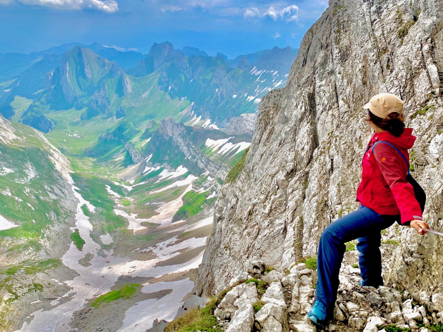
The Lisengrat is the ridge hike that runs between Säntis (2502m), the highest peak in northeastern Switzerland, and the neighboring Altmann (2435m), a shining spire to the east. This rocky, chain and ladders-protected ridgeline is surely a highlight for any hike in the Alpstein range.
Lisengrat Ridge Hike Statistics:
Distance: 2.1km
Duration: 1 hour
Elevation: Starting at 2502m (Säntis Peak) going downwards to 2122m (Rotsteinpass)
Difficulty Level: Medium (but not for anyone afraid of heights)
You can of course combine the Lisengrat Ridge Hike with many other routes as we did, which I will mention further below.
Lisengrat Ridge Hike from Säntis – My Experience:
To say that this was an unforgettable and epic hike is downplaying it, particularly because of our battle with the natural elements that morning.
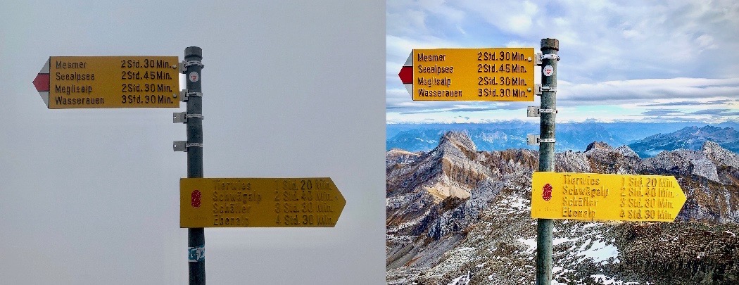
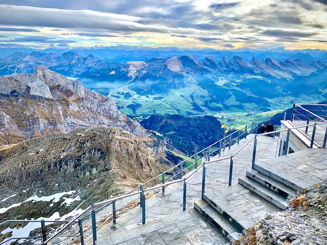
As we were heading up Säntis in the cable car from Schwägalp, it started to rain. Within seconds came the thunders and lightning. The 360 panoramic view I previously saw of the six countries from the top was nowhere present. We saw Säntis showing its true colours as the place that receives the most lightning in Switzerland.
Just so you understand how bad it was, the picture below shows what it was like on that morning versus when I visited 7 months prior.
Tracking the weather and knowing we just had to wait it out for 40 minutes before it would (miraculously) clear up, we sat down for coffee at the restaurant at the top while the men were telling me about all the different kinds of gear they have and that I should invest in using the Transa gift card they had just so kindly given me.
Growing up in Malaysia and not one who tracks weather by the minute, I was in absolute disbelief as my friend told us to start gearing up as it would (supposedly) stop raining in 5 minutes. The women next to our table looked at us in shock and horror as we started layering up our gear.
True to Swiss weather forecast precision, it stopped raining when we headed out – but visibility was still poor. Our first steps onto the Lisengrat Ridge Hike was in snow.
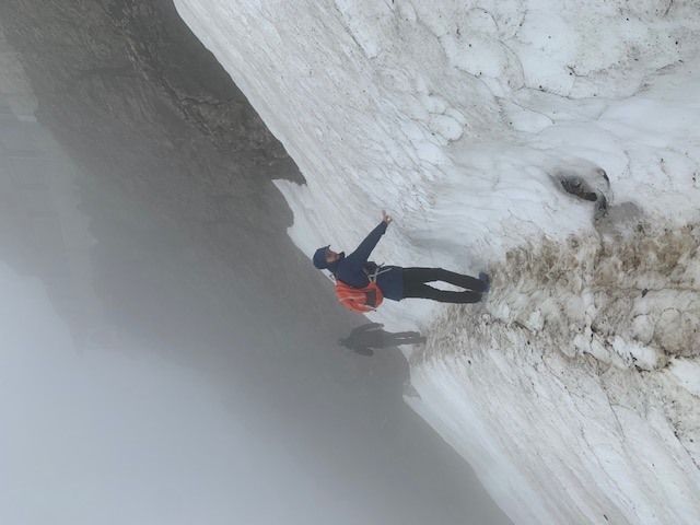
The winds were blowing at incredible speed. I was honestly scared that I would be blown off the mountain.
Visibility was truly not great. I could not see where we were heading to.
This was one of those moments in life when I knew I really couldn’t think – or allow myself to feel scared. It was now or never. I couldn’t be in safer hands with these two men.
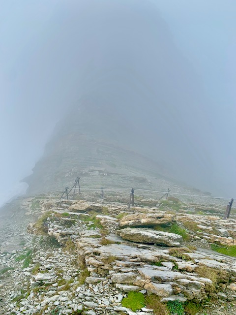
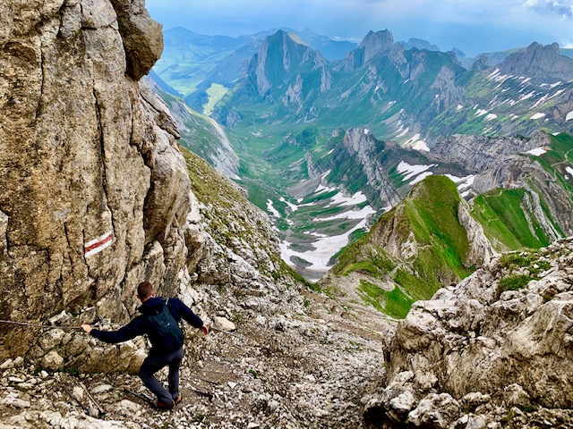
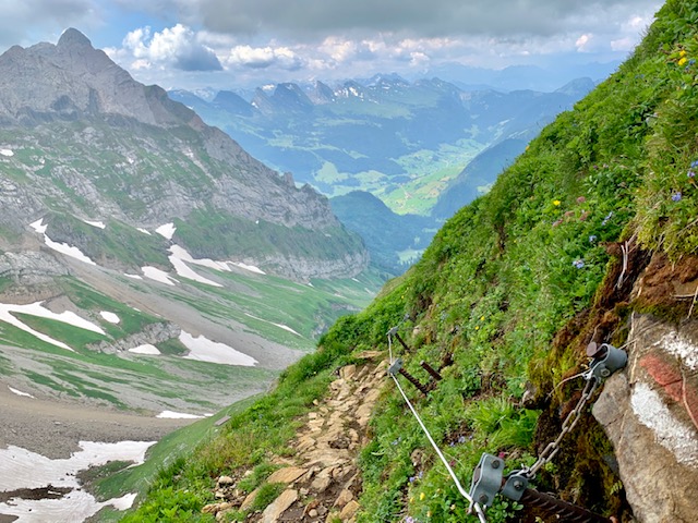
Climbing up this portion of the ridge seemed a little daunting at first, but it was great as we were suddenly sheltered from the merciless winds. I hung on dearly to the chains connected to the steel cables created by the local section of the Swiss Alpine Club in 1905.
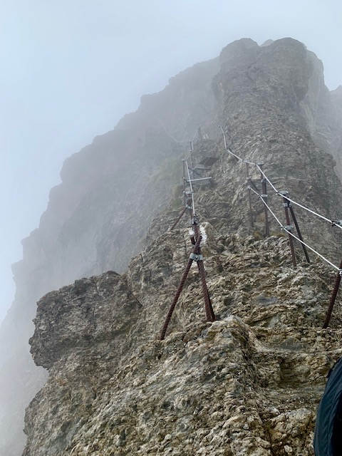
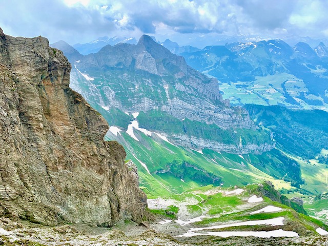
Soon, we were back in the wind but the clouds had started moving away. We could finally start to see the Lisengrat Ridge Hike ahead of us.
Looking back, the Säntis peak was still invisible.
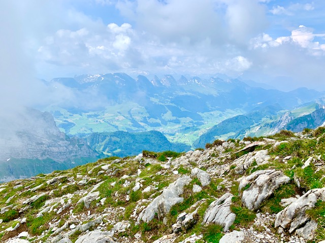
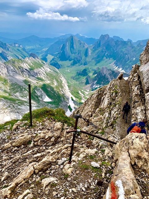
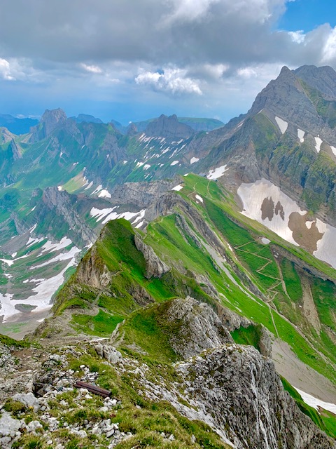
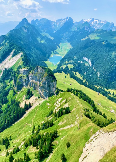
The clouds kept moving away and the view only got better and better. The picture below was the view of the Swiss Alpstein range on our left, the direction we were heading towards.
I could finally see the view of the Swiss Alps in the distance to our right.
Click here to see the comparison of the same (but much better) view I had 7 months prior.
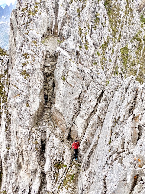
The path started getting narrower and the drops on both sides looked intimidating.
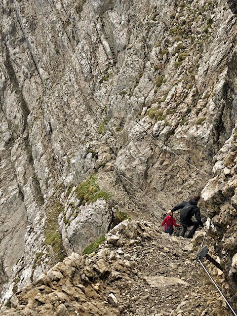
Suddenly we could see two hikers walking on the snowy Lisengrat Ridge Hike in the distance – wearing short sleeve t-shirts and shorts! Can you spot them in the picture below?
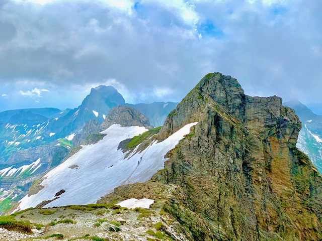
Passing them, they mentioned they had started their hike at 7am from Wasserauen. It was around 11.15am then.
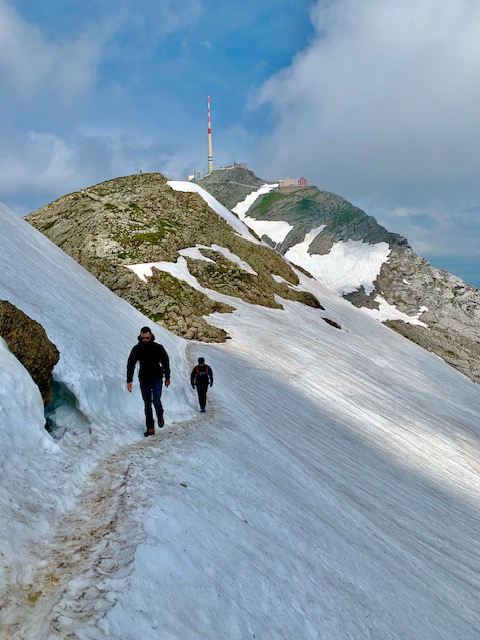
We made our way onto the snow.
The clouds had cleared further and I could now see the peak of Säntis behind me.
After the snowy trail, the path changed once more and became similar to the narrow rocky start. The chains reappeared and I mostly made sure to hold onto them with one hand.
Psychologically, they really helped.
Have I mentioned the unbelievable views?
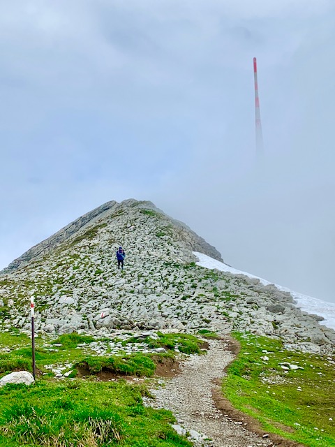
It was a little up and down, up and down at this point.
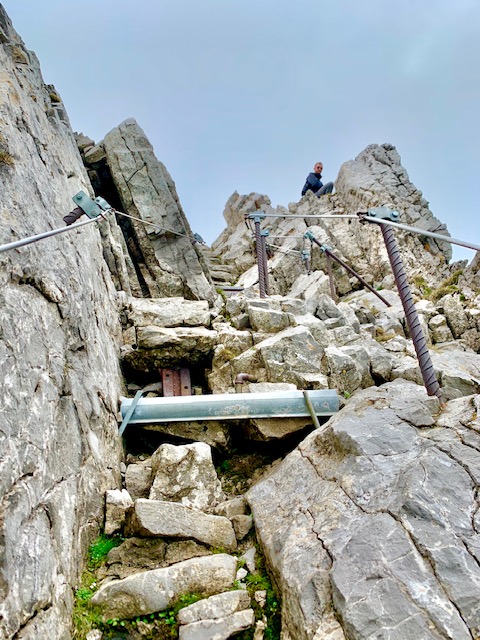
Finally, we saw THE staircase that was hewn directly into the ridge.
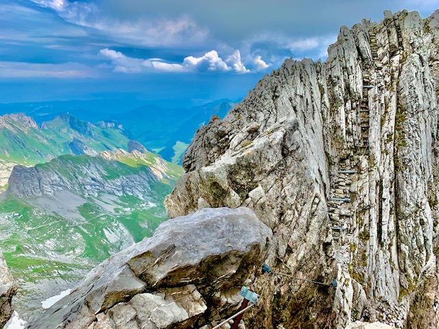
But first you have to go downwards.
Once again, I’m going to go out there to say this is really – not – for people who are afraid of heights. However, I really do not think it is dangerous. The path is narrow, but wide enough for anyone to comfortably make the hike.
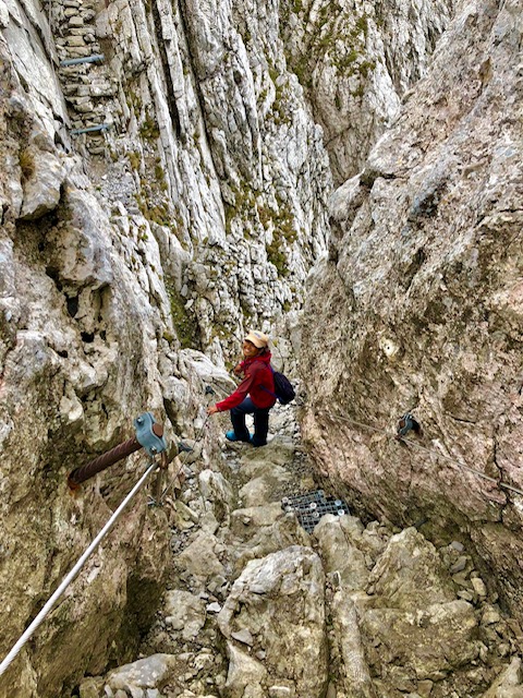
Here is a close-up picture of what it was like climbing that staircase.
Passing this, the views opened up once more.
And soon, so did the path.
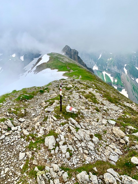
Five minutes later, the Rotsteinpass Hut slowly came into view as the path narrowed once again. It was then a downward zigzag trail till the end of the Lisengrat Ridge Hike from Säntis – which is the Rotstein Pass.
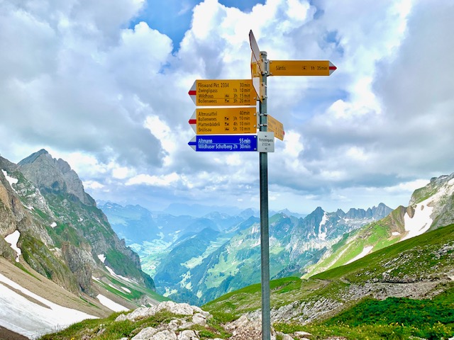
It was also the first time that I saw the blue alpine trail markers going upwards to Altmann.
That concludes our trip on the amazing Lisengrat Ridge Hike from Säntis.
It was however not the end of our hike.
We continued to make our way down to Meglisalp (this was when I unfortunately sprained my ankle but also saw a family of ten ibex, a mountain goat, two marmots running, horses, cows and goats) and then further down to Seealpsee.
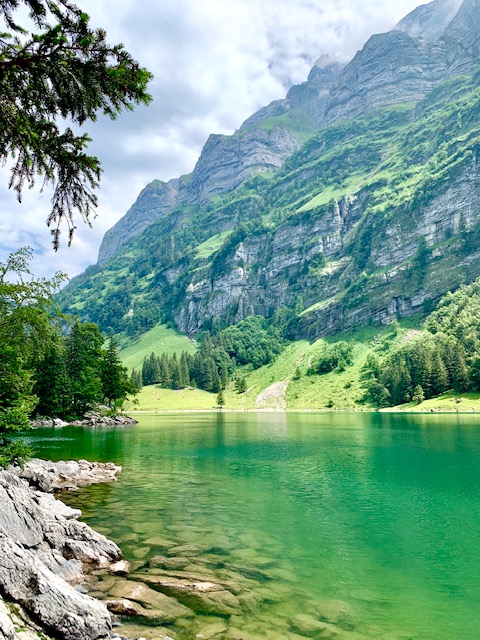
After a short break on the lake, we climbed up to the famous restaurant in the cliffs Aescher-ai and onwards to Ebenalp through the Wildkirchli Caves. From Ebenalp, it was a cable car ride down to Wasserauen from where I took the train back to Basel.
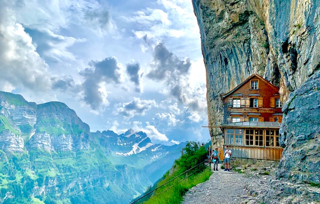
Click here to read about my first visit to Aescher-ai. Be aware that the new owners as of 2018 stopped serving the most delicious rösti in Switzerland. 🙁
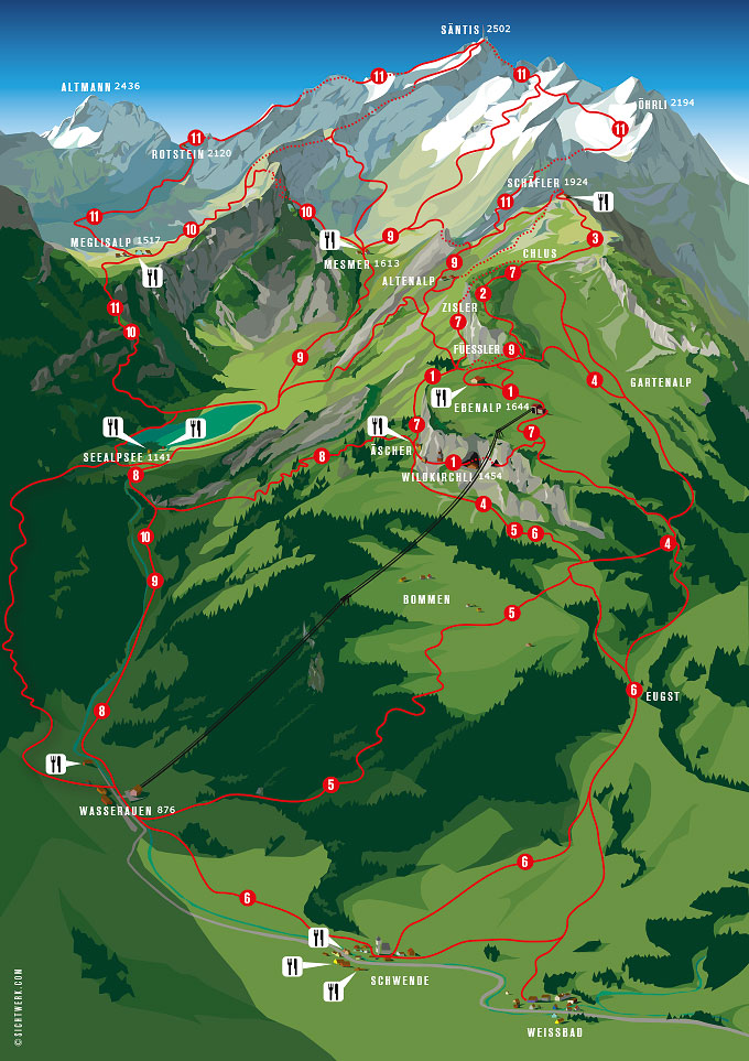
Our entire hike was 12 km, 577m ascend, 1350m descend, just under 4.5 hours moving time.
You can make out our route in the map below. The Lisengrat ridge hike is labeled number 11 from Säntis to the left towards Rotstein.
The next time I come back, I intend to hike up Säntis from Ebenalp via Schäfler and Oehrli.
Lisengrat Ridge Hike from Säntis – My Impressions:
There was so much to love about the Lisengrat Ridge Hike from Säntis.
In my honest opinion, if you are a confident hiker who is not afraid of heights and have the correct gear (most importantly good shoes), this is definitely a hike for you.
It offers amazing views (click here to read about our first visit to Säntis) and a good amount of adrenaline.
.
.
.
Some other hikes I have done in this area include:
Brülisau – Sämtisersee – Hoher Kasten – Brülisau (872m ascend, around 14km and 4 hours – but I ran downhill and had really amazing stamina when I did this)
Hoher Kasten – Saxer Lücke – Bollenwees – Brülisau (This is a big hike – 16km, 654m ascend, 1516m descend, around 6+ hours. Beware that the hike down to Brülisau is BRUTALLY steep and can be really rough after a long hike). Read more here.
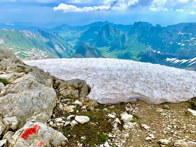
Both the above would offer this amazing view below.
If you’re just looking for an easy trip up to Säntis (possibly my favourite mountain) with the cable car from Schwägalp for a weekend getaway, read more about our experience here.
If you’re looking for other places to visit (including hikes) around Switzerland, click here.

