
Hiking to Stockhorn via the Leiterenpass was a hike I had learnt about when we did the Gantrisch Panorama Trail. It was the 23rd of June 2020, my 5th solo hike and 9th big hike of the year.
Hiking to Stockhorn – Statistics:
Start Point: Gurnigel Wasserscheide Bus Stop (1589m)
End Point: Stockhorn (2190m)
Distance: 11.1km (I did 19km by the end of the day – see below)
Ascend: 949m
Descend: 398m (or as I did a total of 1340m by hiking down from the middle Chrindi cable car station (1642m) to Erlenbach im Simmertal (700m) which was a further 1-hour hike if you are fast)
Hiking to Stockhorn – My Impressions:
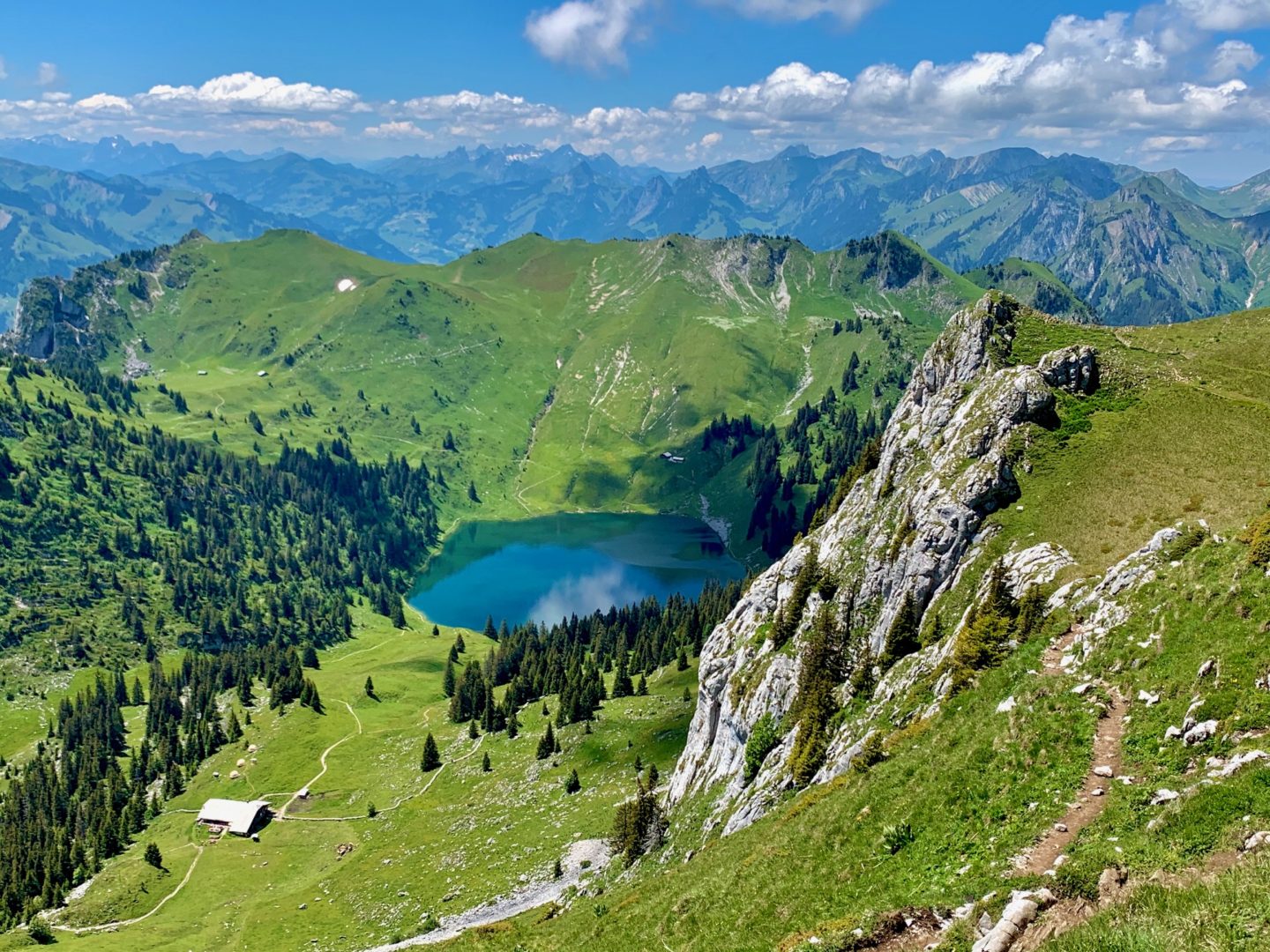
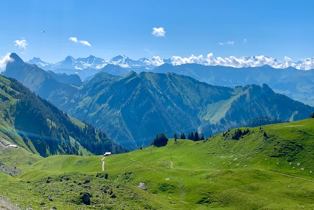
This was a beautiful hike throughout, but certainly got more stunning towards the end.
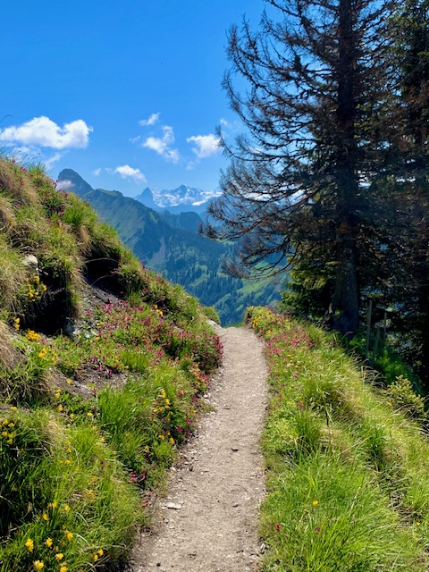
You start off with views of two imposing mountain peaks and you soon start climbing up towards the Leiterenpass.
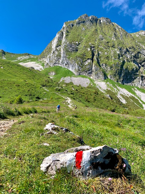
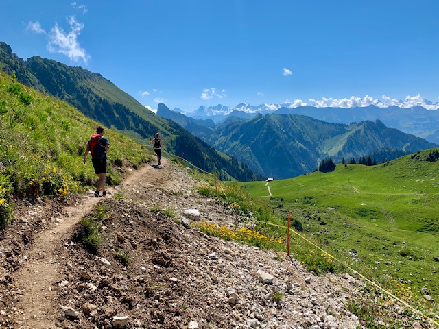
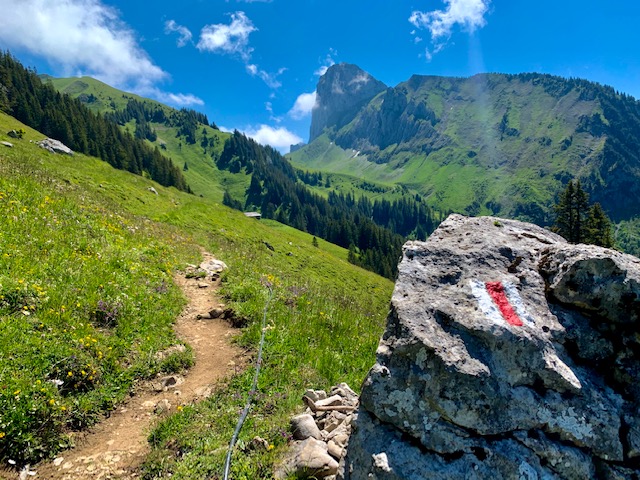
The ascent is a wide rocky path and I would ask you to keep your eye out and spot any climbers on the mountain on your right as there is the Klettersteig Gantrisch.
Suddenly I could hear the sound of the whirring blades of a rescue helicopter.
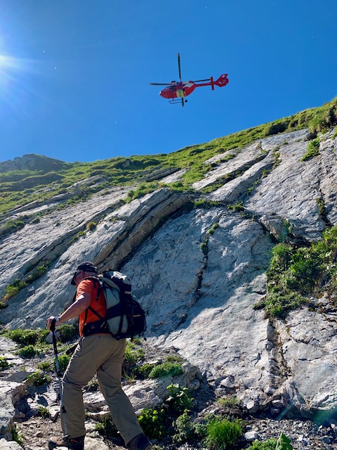
Someone had somehow fallen off the top of the Leiterenpass and everyone had to stop and wait for her to be rescued.
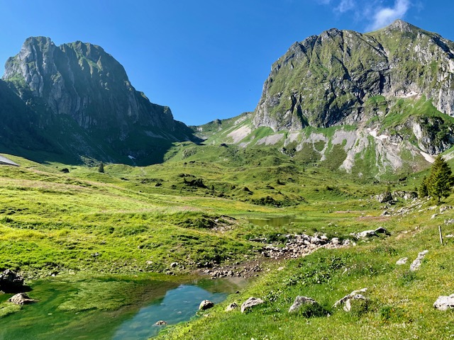
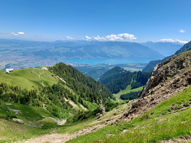
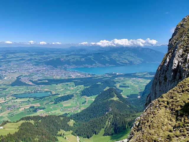
The views from the other side of the Leiterenpass opened up and I could now see the snowcapped mountains in the distance.
It was amazing to see my first helicopter mountain rescue. The speed and seeming precision of the entire operation reminded me that I had to register the whole family for rega.ch – anyone wanting to hike in the mountains should most definitely sign up for this.
I must have been stuck there for about 15 minutes.
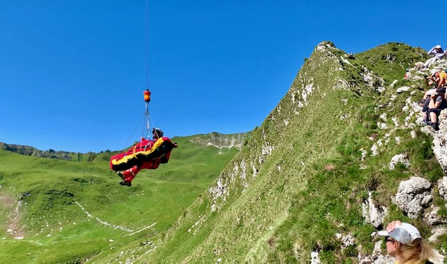
After the lady was taken away by the helicopter, I was back on the path once more.
Seeing her being rescued psychologically affected me a little and I felt just a tiny bit scared that something could happen to me – and I was alone. However, I was confident of my hiking abilities. I have had quite a number of solo hikes under my belt by this time.
The views to my right were just beautiful. The greenery, the space, the fresh air – it was all I was hoping for.
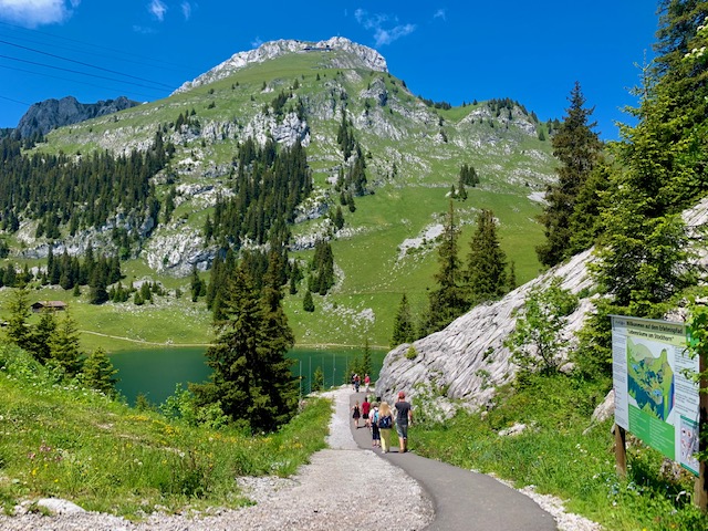
Finally, I got my first glimpse of Stockhorn with its striking rock dome – far left in picture below.
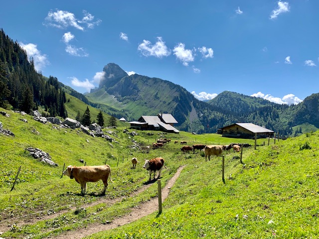
The hike took me past a number of farms. I’m not great with animals and was once again scared that the cow would decide to harm me. Luckily, again, I survived. I was reminded of the hike in the Sardona Trail when I thought a sheep was going to kill me.
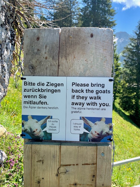
I came across the funniest sign below at some point.
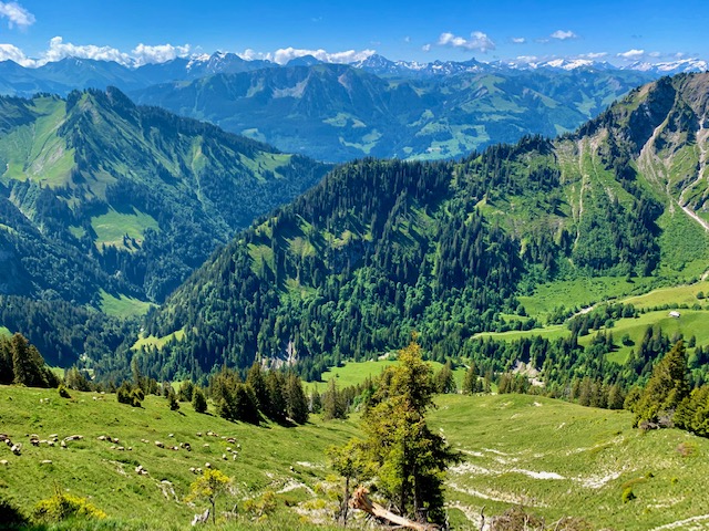
The view of Stockhorn only got clearer and clearer as I started the slow ascent.
Finally, I had my first view of Lake Thun.
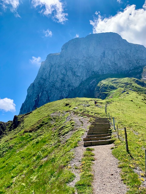
From the Oberi Walalp, the route leads to the last steep climb to the ridge and finally to the peak of Stockhorn. It was a serious climb to the end.
Suddenly these tiny flies swarmed me. I was in so much discomfort. They were on every inch of my skin. I hated that they would fly and get stuck in my sunglasses and on my forehead between my cap and sunglasses.
It was absolute torture. I even considered turning back but realized that would be crazy to do. Suddenly thoughts of midnight kayaking and a picnic on an iceberg in Greenland seemed like a distant dream – I couldn’t bear these tiny insects swarming around me!
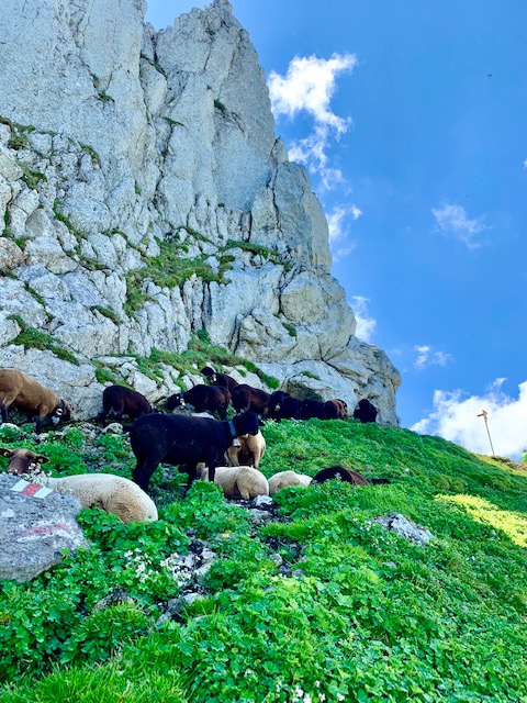
I had to keep me face downwards or they would be all over my face. I couldn’t see where I was going – just upwards. Imagine my shock when suddenly possibly the fattest sheep in Switzerland appeared right on my tracks!
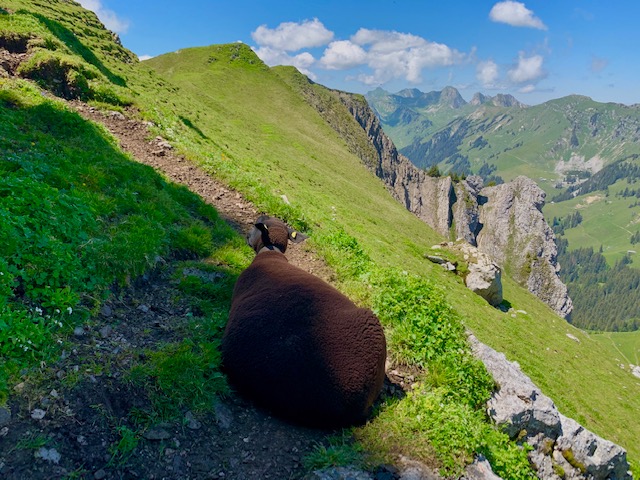
Have you ever seen a fatter sheep? The others were chilling by the side of the mountain.
Thankfully, finally, the flies were gone. I was at the top of the ridge. I took a left turn and continued my way towards the top of Stockhorn.
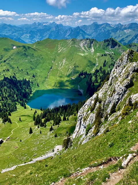
Turning back, I had my first views of the Oberstockesee. It was so beautiful.
I could finally see the restaurant at the top of Stockhorn.
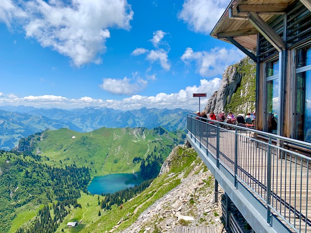
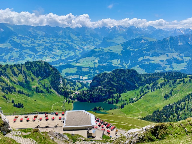
I continued making my way up, passing it, heading towards the peak. The panoramic view of the surrounding mountains and Hinterstockensee was nothing short of magnificent.
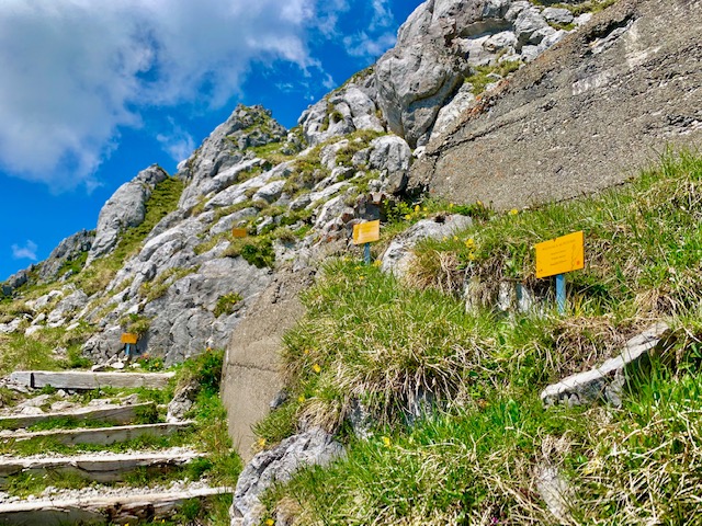
There were little yellow signs with the names of the different Alpine plants and herbs along the path towards the peak.
I made my way back down and did a quick pitstop for more views after going through a tunnel by the restaurant.
Half-way down with the cable car, I realized that I would miss my hourly train and instead of waiting 50 minutes, I got off at the middle Chrindi cable car station (where you can go fishing and there is a playground for kids, also where I believe you can bungee jump over the lake) and hiked all the way down to Erlenbach in Simmertal.
The first part of the hike was a little steep but being in the forest, shaded from the heat, was very nice.
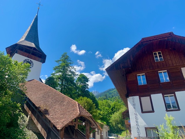
Erlenbach im Simmertal was a quaint little town.
Hiking to Stockhorn via the Leiterenpass was certainly a memorable hike.
It was another great day hiking in the Swiss Alps.
.
.
.
For other posts in Switzerland, click here.

