
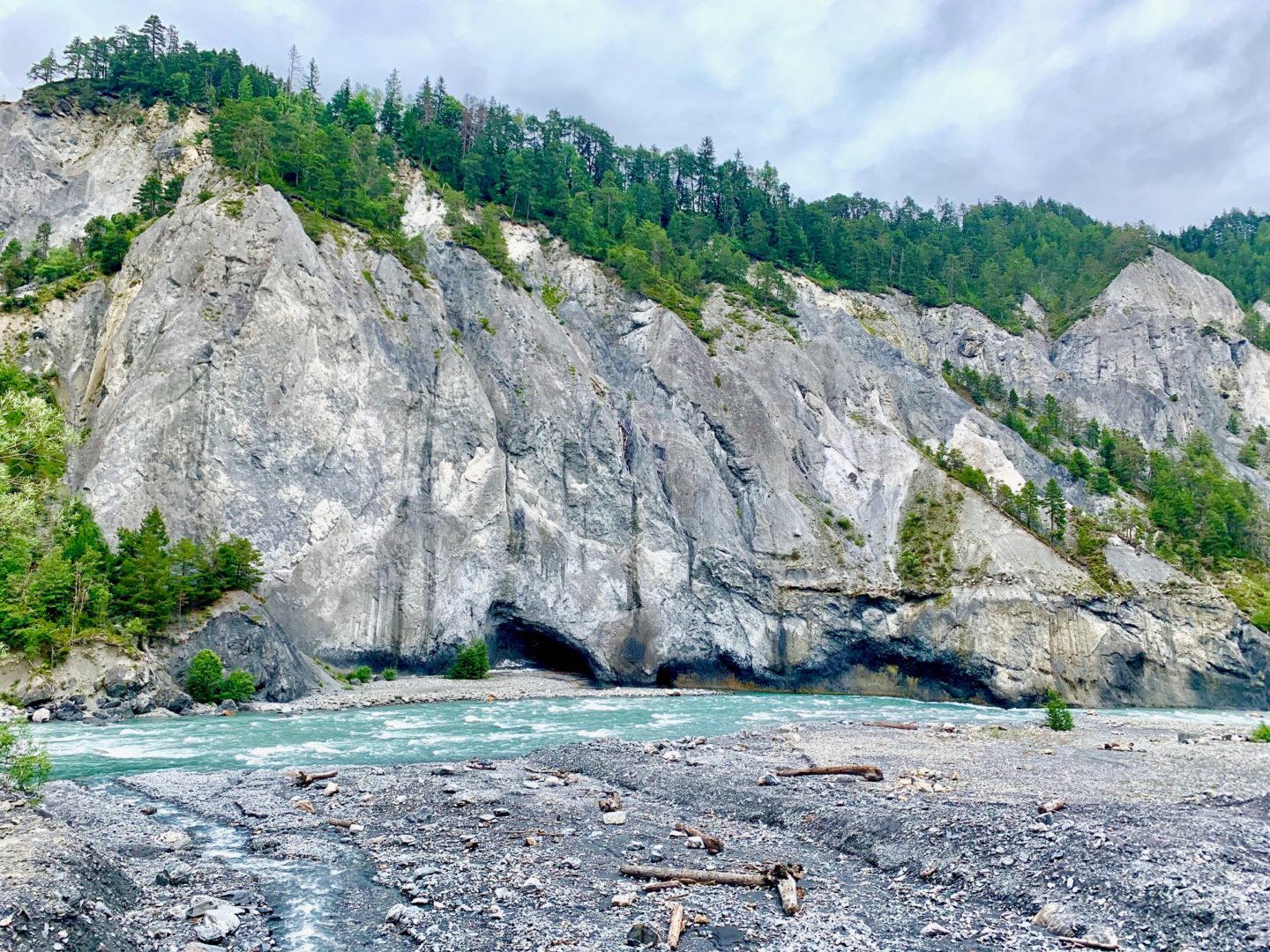
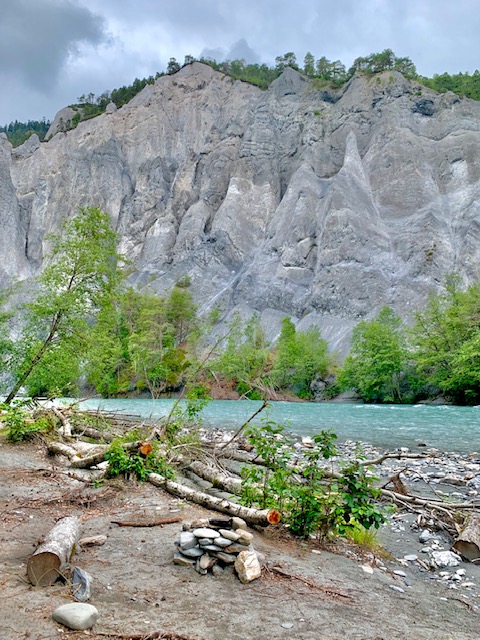
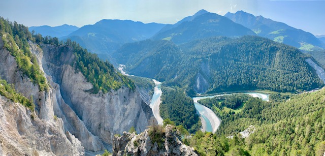
The picturesque Rhine Gorge Hike is an easy hike offering one of the most magnificent and diverse landscapes in the Alps. Known as Ruinaulta in Romansh, this natural monument was carved out from the prehistoric Flims Rockslide over 10,000 years ago, at the end of the last Ice Age.
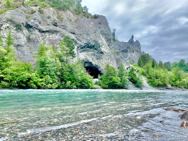
Hiking along the Rhine’s emerald blue waters with its imposing walls reaching heights of up to 300 meters was an unforgettable experience.
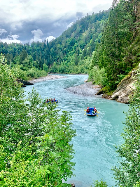
This Little Swiss Grand Canyon located close to Lake Toma, its official source, offers a host of activities such as hiking, kayaking and river rafting.
The Rhine Gorge Hike – Statistics:
For once, I cannot in good faith put any particular numbers here.
I’ve seen so many varying distances and none add up to the statistics I was given by my iphone after actually completing the hike.
Starting point: Ilanz train station (698m)
End point: Reichenau-Tamins train station (604m)
Please note: The section between Versam-Safien Station (635m) and Trin Station (609m) is not accessible on foot. You either have to take the hourly Rhaetian Railway (every 38 minutes past the hour) which takes 5 minutes OR go on a 8.5km detour hike on the other side of the gorge up to Trin Digg which takes 3 hours.
Distance: About 17km
Duration: 4+ hours (take into account that if you miss the hourly train, there will be quite some waiting to do)
The Rhine Gorge Hike – My Experience:
Starting from Ilanz train station, you have to cross a road-bridge before turning left into the forested area where your hike really starts.
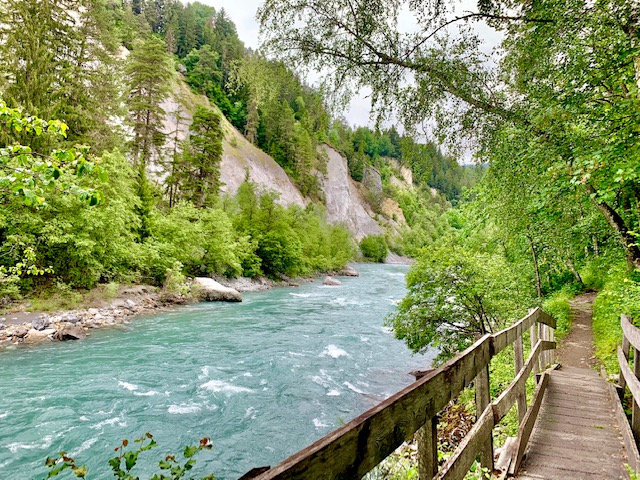
For the most part throughout the hike, you are walking very close to the river (and sometimes also the train tracks). This area is a nature preserved zone with protected orchids and rare birds along the banks.
This was a very easy hike that was mostly always flat. It is certainly doable with small kids.
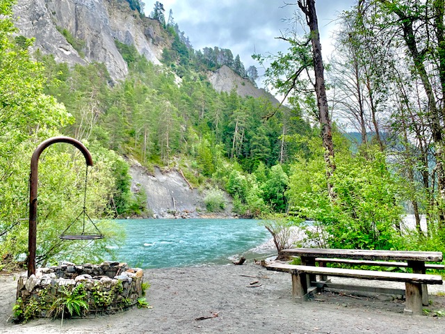
There are many designated picnic spots along the Rhine, so be sure to bring some things to grill if you can pack that into your day.
You will also pass 9 interactive information points along the route from which you can learn more about the geological, biological and cultural history of the area.
There was a portion that went uphill and further away from the river, into the forest, as I was reaching Versam-Safien station.
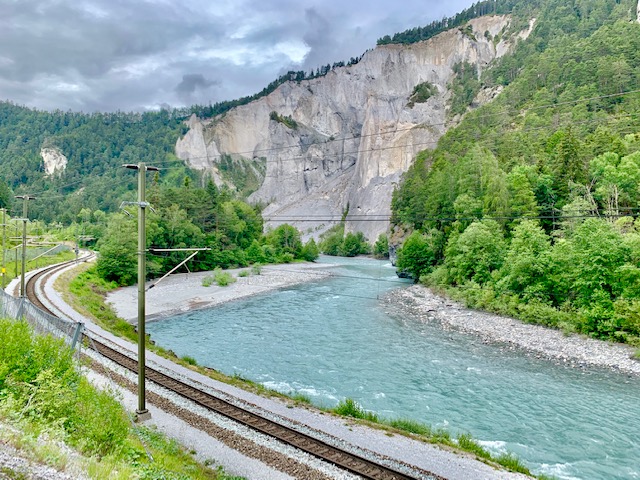
As the train was only once per hour, I went further on and saw the best view so far on the hike. I made sure to time myself so I could get back on time.
If you’d rather have a coffee, there is a gluten-free and vegan bakery right next to the Versam-Safien station. You can also book yourself onto rafting trips at the local canoe school.
It was a short 5 minutes train ride from Versam-Safien to Trin station.
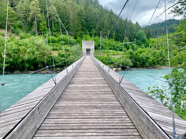
Arriving at the Trin station, be sure to do a small detour in the opposite direction of your hike to the timber suspension bridge that connects the villages Trin and Bonaduz.
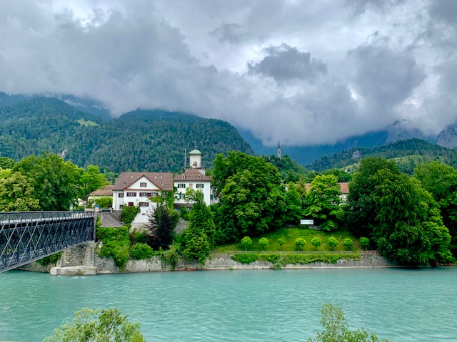
Continuing my hike towards Reichenau-Tamins, I could suddenly hear voices and spotted two rafts coming down the river. Oh, how I wish I was on the water instead! It reminded me of the time I went rafting in Interlaken.
Soon enough, I was in Reichenau-Tamins waiting for the hourly train to make my long way back home.
Overall, the Rhine Gorge Hike was a nice and easy hike, but I realized I would rather be high up in the mountains for a more strenuous and difficult hike instead.
.
.
.
We later saw the Rhine Gorge from the Il Spir observation deck when we did a hike from Flims Waldhaus to Caumasee, Il Spir and onwards to Crestasee and Trin Mulin. The view was breathtaking.
.
.
.
Click here for my other posts in Switzerland.


I would like to do only Ilanz to Versam-Safien Station. Ho wmuch time and what distaance that would be?